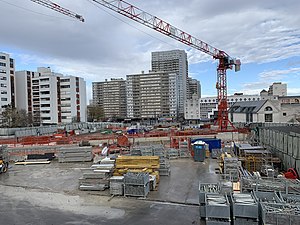
Mairie de Vitry-sur-Seine station
This article relies largely or entirely on a single source. (May 2024) |
Mairie de Vitry-sur-Seine | |||||||||||
|---|---|---|---|---|---|---|---|---|---|---|---|
 Mairie de Vitry-sur-Seine station construction in March 2021 | |||||||||||
| General information | |||||||||||
| Location | Vitry-sur-Seine France | ||||||||||
| Coordinates | 48°47′24″N 2°23′14″E / 48.7899222°N 2.38721944°E | ||||||||||
| Owned by | Société du Grand Paris | ||||||||||
| Operated by | ORA (RATP Dev, Alstom and ComfortDelGro) | ||||||||||
| Platforms | 2 side platforms | ||||||||||
| Tracks | 2 | ||||||||||
| Connections | |||||||||||
| Construction | |||||||||||
| Structure type | Underground | ||||||||||
| Depth | 27 m (89 ft) | ||||||||||
| Accessible | Yes | ||||||||||
| Architect | Abdelkader Benchamma | ||||||||||
| Other information | |||||||||||
| Station code | GA15 / 15VIC | ||||||||||
| Fare zone | 3 | ||||||||||
| History | |||||||||||
| Opening | Late 2015 | ||||||||||
| Services | |||||||||||
| |||||||||||
Mairie de Vitry-sur-Seine station is an upcoming underground station on Line 15 of the Paris Métro. It is part of the Grand Paris Express project. The station is located in the town of Vitry-sur-Seine at the intersection of Rue Édouard-Tremblay and Avenue Maximilien-Robespierre.
The station will serve as an interchange point between Line 15 and Île-de-France tramway Line 9, and will be located close to the Vitry-sur-Seine Town Hall (Mairie de Vitry-sur-Seine), Val-de-Marne Museum of Contemporary Art and Coteau-Marcel Rosette Park.[1]
References[edit]
- ^ "La gare Mairie de Vitry-sur-Seine". Grand Paris Express. Retrieved 14 May 2024.
