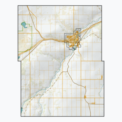
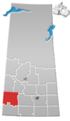
Wymark, Saskatchewan
Wymark | |
|---|---|
Organized Hamlet | |
 Aerial view of Wymark (2013) from south by southeast | |
| Nickname: Home of the Big Cheese | |
| Coordinates: 50°06′35″N 107°44′13″W / 50.1097°N 107.7369°W | |
| Country | Canada |
| Province | Saskatchewan |
| Region | Southwest Saskatchewan |
| Rural Municipality | Swift Current |
| Post Office Established | January 1, 1913 |
| Government | |
| • Reeve | Jerry Knipfel |
| • Administrator | Dave Dmytruk |
| • Governing body | Swift Current No. 137 |
| Area | |
| • Total | 0.30 km2 (0.12 sq mi) |
| Population (2011)[1] | |
| • Total | 130 |
| • Density | 434.1/km2 (1,124/sq mi) |
| Time zone | CST |
| Postal code | S0N 2Y0 |
| Area code | 306 |
| Highways | Highway 379 |
| [2][3][4] | |
Wymark is a hamlet in Swift Current Rural Municipality No. 137, Saskatchewan, Canada. Listed as a designated place by Statistics Canada, the hamlet had a population of 144 in the Canada 2006 Census.[5] The hamlet is located on Highway 628 about 2 km north of Highway 363, and 15 km south of Swift Current. When the existing railway was extended to branch off in another direction, a town formed at this junction. This "Y" formation of the railway, resulted in the town being named Wymark.
Etymology[edit]
Wymark was named after William Wymark Jacobs, an English writer best known for his 1902 story The Monkey's Paw.[6]
Demographics[edit]
In the 2021 Census of Population conducted by Statistics Canada, Wymark had a population of 148 living in 54 of its 57 total private dwellings, a change of 7.2% from its 2016 population of 138. With a land area of 0.32 km2 (0.12 sq mi), it had a population density of 462.5/km2 (1,197.9/sq mi) in 2021.[7]
See also[edit]
References[edit]
- ^ "2011 Community Profiles". Statistics Canada. Government of Canada. Retrieved August 21, 2014.
- ^ National Archives, Archivia Net. "Post Offices and Postmasters". Archived from the original on October 6, 2006. Retrieved August 21, 2014.
- ^ Canadian Textiles Institute. (2005), CTI Determine your provincial constituency
- ^ Commissioner of Canada Elections, Chief Electoral Officer of Canada (2005), Elections Canada On-line | Home, archived from the original on April 21, 2007
- ^ Canada 2006 Census: Designated places in Saskatchewan
- ^ Barry, Bill (September 2005). Geographic Names of Saskatchewan. Regina, Saskatchewan: People Places Publishing, Ltd. p. 466. ISBN 1-897010-19-2.
- ^ "Population and dwelling counts: Canada and designated places". Statistics Canada. February 9, 2022. Retrieved August 31, 2022.


